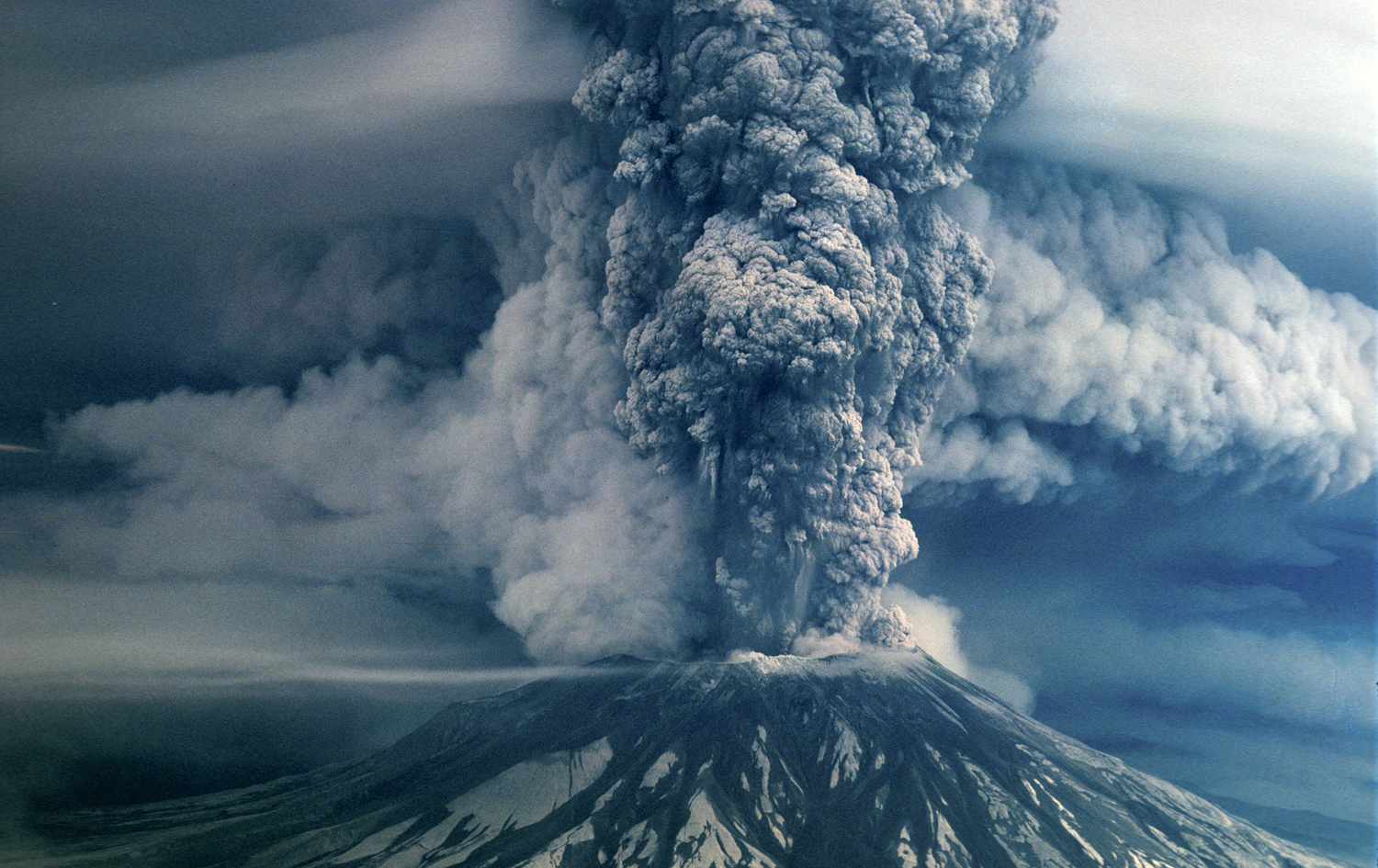
Called Louwala-Clough, or “the Smoking Mountain,” by Native Americans, Mount St. Helens is located in the Cascade Range and stood 9,680 feet before its eruption. The volcano has erupted periodically during the last 4,500 years, and the last active period was between 1831 and 1857.
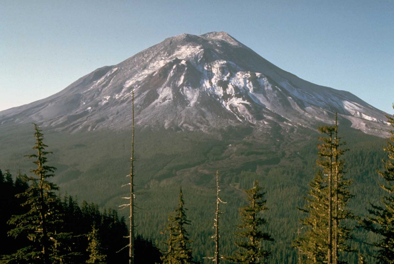
On March 20, 1980, noticeable volcanic activity began again with a series of earth tremors centered on the ground just beneath the north flank of the mountain. These earthquakes escalated, and on March 27 a minor eruption occurred, and Mount St. Helens began emitting steam and ash through its crater and vents.
Small eruptions continued daily, and in April people familiar with the mountain noticed changes to the structure of its north face. A scientific study confirmed that a bulge more than a mile in diameter was moving upward and outward over the high north slope by as much as six feet per day. The bulge was caused by an intrusion of magma below the surface, and authorities began evacuating hundreds of people from the sparsely settled area near the mountain. A few people refused to leave.
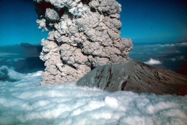
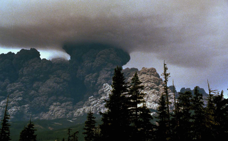
On the morning of May 18, at 8:32 a.m, Mount St. Helens was shaken by an earthquake of about 5.0 magnitude, and the entire north side of the summit began to slide down the mountain. The giant landslide of rock and ice, one of the largest recorded in history, was followed and overtaken by an enormous explosion of steam and volcanic gases, which surged northward along the ground at high speed. The lateral blast stripped trees from most hill slopes within six miles of the volcano and leveled nearly all vegetation for as far as 12 miles away. Approximately 10 million trees were felled by the blast.
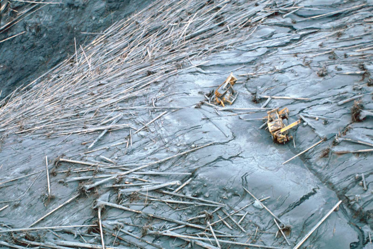
The landslide debris, liquefied by the violent explosion, surged down the mountain at speeds in excess of 100 miles per hour. The avalanche flooded Spirit Lake and roared down the valley of the Toutle River for a distance of 13 miles, burying the river to an average depth of 150 feet. Mudflows, pyroclastic flows, and floods added to the destruction, destroying roads, bridges, parks, and thousands more acres of forest.
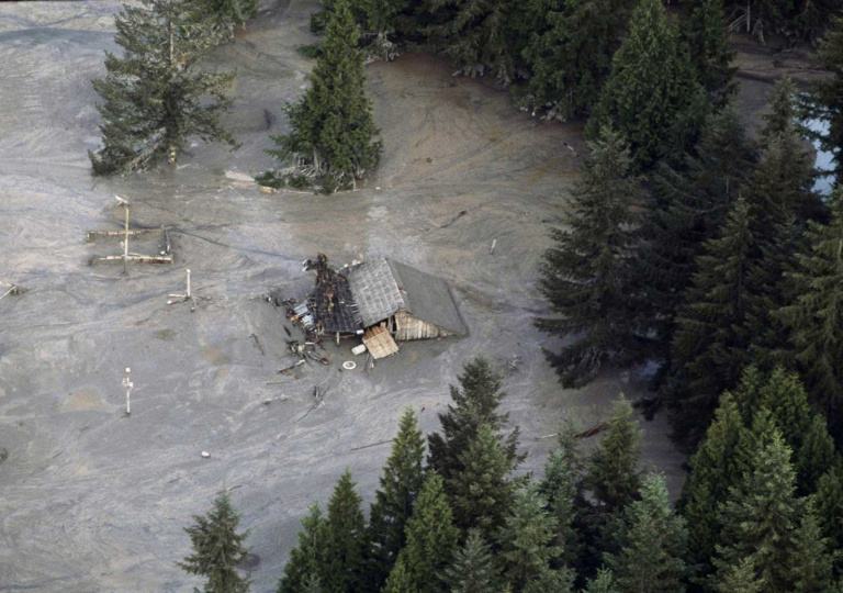
Simultaneous with the avalanche, a vertical eruption of gas and ash formed a mushrooming column over the volcano more than 12 miles high. Ash from the eruption fell on Northwest cities and towns like snow and drifted around the globe within two weeks. Fifty-seven people, thousands of animals, and millions of fish were killed by the eruption of Mount St. Helens.
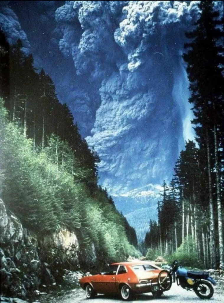
By late in the afternoon of May 18, the eruption subsided, and by early the next day it had essentially ceased. Mount St. Helens’ volcanic cone was completely blasted away and replaced by a horseshoe-shaped crater–the mountain lost 1,700 feet from the eruption. The volcano produced five smaller explosive eruptions during the summer and fall of 1980 and remains active today. In 1982, Congress made Mount St. Helens a protected research area.

Mount St. Helens became active again in 2004. On March 8, 2005, a 36,000-foot plume of steam and ash was expelled from the mountain, accompanied by a minor earthquake. Though a new dome has been growing steadily near the top of the peak and small earthquakes are frequent, scientists do not expect a repeat of the 1980 catastrophe anytime soon.
Source: https://rarehistoricalphotos.com
https://www.livescience.com

